AI and computer vision: the future of construction and real estate
AI and computer vision are transforming construction and real estate through automation and real-time insights.

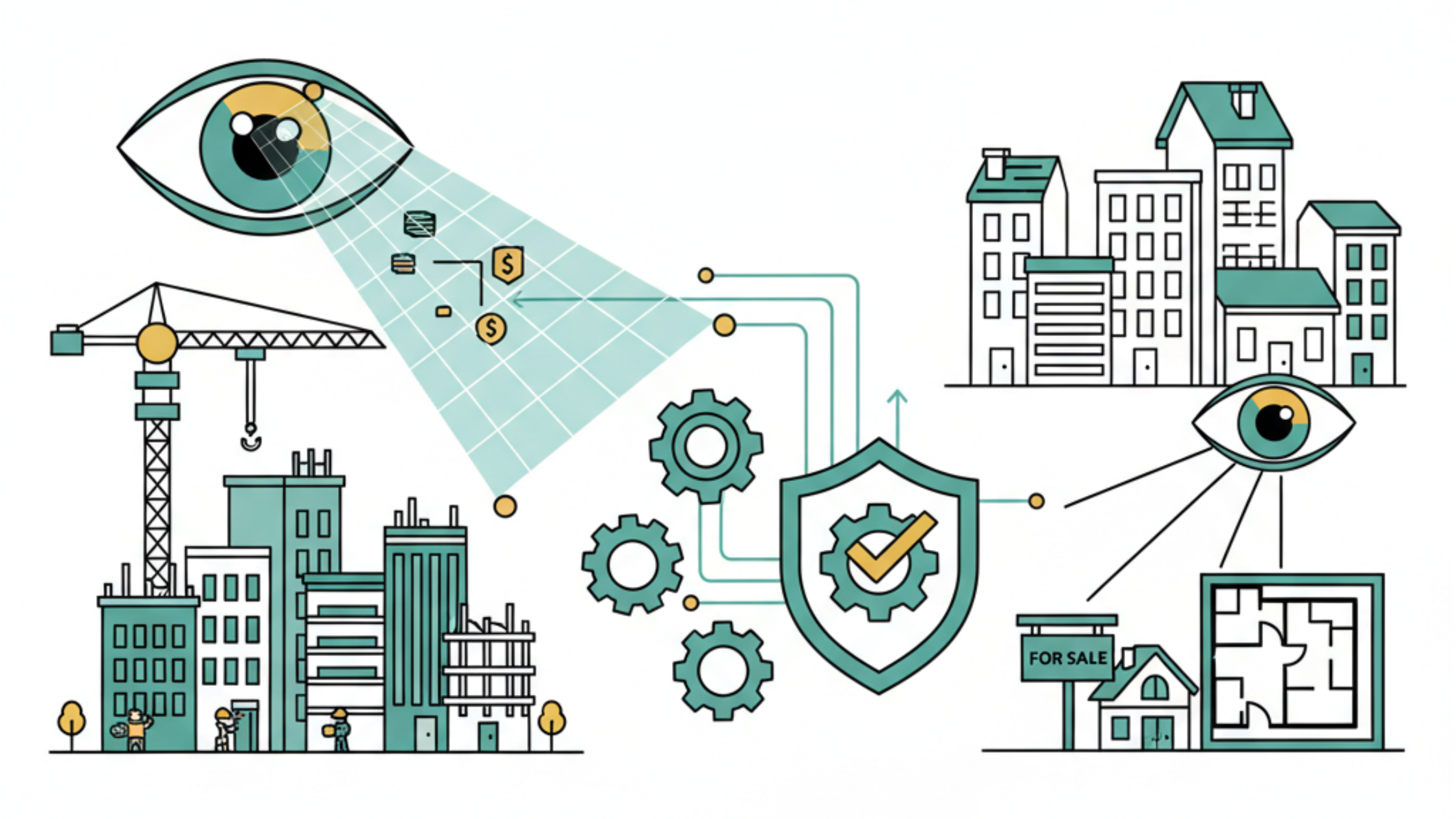
In recent years, Computer Vision has gone from being an emerging technology to becoming a key tool for industries that have historically been more traditional, such as construction and real estate.
It is one of the most powerful applications within a broader shift toward artificial intelligence in construction, a sector where adoption is still low but momentum is accelerating fast.
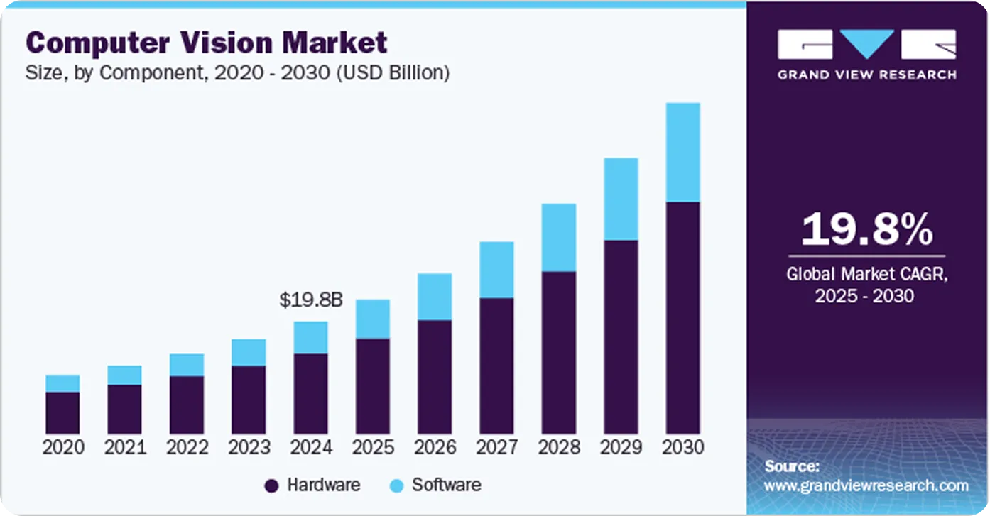
Its impact is already measurable: the global computer vision market reached almost 20 billion dollars in 2024 and is projected to grow at over 19% annually.
At Crata AI, we have confirmed first-hand in our projects that Computer Vision technologies not only drive efficiency but also redefine the standards of safety, sustainability, and profitability in the sector.
In this blog, we explore use cases, trends, and real-world applications of Computer Vision that are transforming construction and real estate.
What is computer vision?
Computer Vision is a branch of artificial intelligence that allows machines to interpret and understand the visual world, emulating the human ability to see and process images.
It uses advanced machine learning algorithms and neural networks to analyze visual data such as photographs, videos, or 3D images, identifying patterns, objects, and relevant characteristics.
In construction, this technology is applied to automate tasks such as site inspection, real-time defect detection, project progress monitoring, and improving safety in the workplace. Furthermore, it facilitates inventory management and resource planning by analyzing images from drones or cameras installed on-site.
Since its implementation throughout all processes, Computer Vision has proven to be a valuable tool in construction, contributing to greater efficiency and precision in projects.
Computer vision advantages in construction and real estate
Constant supervision
Artificial vision systems allow for the automated, real-time monitoring of construction sites, immediately detecting problems or delays.
Precision in error and anomaly detection
Thanks to advanced algorithms, it's possible to identify defects, deviations, and risks in construction, as well as evaluate the state of properties, detecting structural or maintenance issues before they turn into major problems.
Automatic documentation
Every phase of a construction project or property inspection can be recorded automatically, generating detailed reports without exclusively relying on manual inspections.
Improved coordination
The captured information integrates with project management platforms, facilitating communication between on-site teams and offices, and streamlining decision-making.
Adaptability to different projects
The technology adjusts to projects of any size and complexity, from small constructions to large real estate developments.
Property evaluation and analysis in real estate
Computer Vision technology allows for the analysis of property characteristics, from finishes and structures to overall condition, assisting with valuation, maintenance and real estate investment decision-making.
Use cases in construction
Construction site monitoring
Worksite monitoring with Computer Vision allows construction progress to be recorded using drones and fixed cameras, capturing images and videos that are automatically analyzed.
These images are compared with the project's plans or BIM models, which makes it possible to identify deviations in real-time, such as errors in the placement of structural elements or misplaced installations, avoiding delays and additional costs from later corrections.
It also recognizes handcrafted elements, ensuring that structures, finishes, or manual details comply with the quality standards defined in the project.
Furthermore, automatic visual reports are generated for stakeholders, showing the state of the work and any detected irregularity without the need for continuous manual inspections.
Finally, Computer Vision applications detect defects in the structures, such as cracks, leaks, or corrosion, at early stages, allowing for corrective actions before problems worsen and repair costs increase.
Overall, this solution ensures that work progresses according to plan, reduces costly errors, improves inspection accuracy, and provides concrete and verifiable information to all project managers.
Worksite safety
Computer Vision applications allow for continuous supervision of workers correctly using their protective equipment, such as a hard hat, reflective vest, and harness (PPE), ensuring that safety regulations are met at all times.
The technology monitors high-risk zones, such as areas with heavy machinery or elevated edges, detecting the presence of people and alerting about possible dangerous situations before accidents occur.
It can also send real-time notifications when someone enters restricted areas, allowing for an immediate response from security personnel.
With this technology, site managers can have a clear and concrete view of security in real-time, anticipating risks instead of reacting to them.
Equipment tracking
Computer Vision technology allows for the supervision of cranes, excavators, heavy vehicles, and the movement of personnel in risk zones. It is capable of detecting falls, accidents, and dangerous situations, and it evaluates the use of space and the efficiency of the machinery, identifying periods of inactivity.
It can read signals in the environment and anticipate possible errors or accidents, generating early alerts. In this way, operating times are optimized, workers are protected, and safer and more controlled use of equipment on site is ensured.
Use cases in real estate
3D modeling and augmented reality with AI
Thanks to the combination of Computer Vision technologies and other branches of artificial intelligence, it is possible to reconstruct the construction site into a 3D model from photos and videos, accurately capturing every detail.
The technology also offers simulations of future scenarios, showing how certain changes could affect the progress or structure of the project, which helps with more proactive planning.
Furthermore, remote supervision becomes more intuitive: the AI highlights problems or risks directly on augmented or virtual reality models, facilitating the identification of issues without the need to be on-site.
Finally, it can analyze visual documentation, such as photos of materials or packaging, predicting possible defects before their use on the construction site.
In this way, architects, engineers, and managers can explore, evaluate, and anticipate the project in a much more interactive and visual manner, with concrete information ready for decision-making.
Automatic property valuation
Computer Vision applications, combined with other AI technologies, allow for the analysis of interior and exterior photos to estimate the value of a property, taking into account its condition, size, finishes, and location.
By comparing the property's characteristics with other similar real estate in the market, it is possible to generate competitive prices adjusted to the sector's reality, also leveraging demand prediction models that help anticipate market variations, as detailed in our article AI Demand Forecasting: The Key to Optimizing Your Business.
In this way, agents, appraisers, and investors can quickly obtain accurate and objective valuations, reducing analysis time and improving decision-making when buying, selling, or investing in properties.
Automated visual content generation
With the help of Computer Vision and Artificial Intelligence technology, a property's photos can be transformed automatically: lighting is adjusted, angles are corrected, and distracting elements are removed, resulting in images ready for listings.
From these same photos, animated virtual tours or promotional videos are created, offering buyers or tenants an immersive experience without the need to physically tour the property.
Thus, real estate agencies and agents can prepare professional content in minutes, increasing the visibility of their properties and capturing the attention of potential clients in a much more attractive and efficient way.
Other use cases
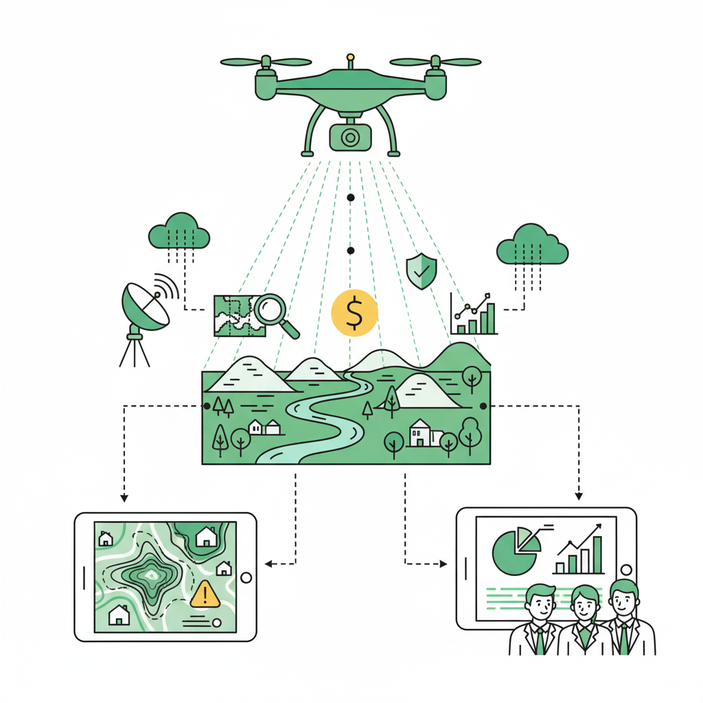
Land analysis
Before any project, understanding the land is key. With Computer Vision and drone or satellite images, dimensions, relief, vegetation, and nearby constructions can be mapped, offering a complete overview without the need for physical visits.
The technology also allows for the identification of potential risks, such as steep slopes or flood-prone areas, and the generation of automatic reports with maps and graphs that facilitate evaluation by investors and developers.
Thanks to this, land analysis becomes a faster and more precise process, which helps to compare locations, evaluate development opportunities, and make decisions based on concrete and verifiable data.
Forestry and environmental analysis with LiDAR and computer vision
What is LiDAR?
LiDAR (Light Detection and Ranging) is a remote sensing technology that uses laser light pulses to measure distances with high precision. By analyzing the time it takes for each pulse to return to the sensor, 3D point clouds are generated, allowing for the creation of detailed models of the terrain and vegetation.
LiDAR and its applications
Automated Forest Inventories: LiDAR allows for the mapping of forest structure and density, facilitating the precise estimation of biomass and timber volume without the need for exhaustive field sampling.
Tree Canopy Modeling: This technology generates detailed 3D models of the canopy, allowing for the analysis of vegetation distribution, tree height, and the structural complexity of the forest ecosystem.
Environmental Risk Assessment: LiDAR is used to identify areas prone to forest fires or landslides, evaluating the fuel load and topography for effective preventive planning.
Monitoring of Land Cover Changes: It facilitates the detection of changes in the landscape, such as deforestation or natural regeneration, providing precise data for decision-making in conservation and land management.
In Crata, our vision is that tools like LiDAR can significantly help companies to make strategic decisions, optimize operations, and generate tangible impact on their business. Our goal is for the sector to be able to innovate, plan effectively, and leverage precise data to improve efficiency and results.
The future of computer vision in construction and real estate
Computer Vision is about to revolutionize the way we build and sell properties. Forget slow methods: this technology is going to completely change the planning, supervision, and management of projects.
In construction: Solve before they fail
In construction, we will see it evolve into systems that predict failures. Thanks to the real-time information collected by drones, sensors, and BIM models, the technology can provide advance warning of a possible delay, a structural problem, or a safety risk before it happens.
This is a radical shift: we no longer react to problems, but solve them proactively. The result: safer construction sites and a much more intelligent use of resources.
In real estate: Valuations and immersive experiences
In the real estate sector, Computer Vision will allow us to provide much more dynamic property valuations. The technology will combine photos, virtual tours, and market data to give super precise, up-to-the-minute estimates.
But not only that. Think about the customer experience. With augmented reality, a client or investor will be able to instantly see what a renovation would look like or how the property will evolve in the future, creating a much more immersive and convincing experience.
Conclusion: The takeoff of intelligent vision
Computer Vision technology is marking an inflection point in construction and real estate. It's not just about digitizing processes, but about completely changing the way we conceive, execute, and manage projects.
Construction sites stop depending on manual inspection to rely on objective visual data and constant monitoring, allowing deviations or safety risks to be identified before they occur.
Meanwhile, properties go from simple listings to interactive experiences with augmented reality and dynamic valuations that show their true potential.
What is most relevant is that this technology does not just improve efficiency: it redefines safety, reduces uncertainty, and accelerates decision-making with reliable and real-time information.
The sector faces an inevitable evolution. Those who integrate computer vision into their operations will not just adapt to the future: they will be the ones who lead it.
Balko Technologies (s.f.). Drone-mounted LiDAR: An indispensable tool for forest management
Borsah, A. A., et al. (2023). LIDAR-Based Forest Biomass Remote Sensing: A Review of Metrics, Methods, and Assessment Criteria for the Selection of Allometric Equations
Meegle Technologies (2026). LIDAR Environmental Monitoring
Aerolaser (2025). LiDAR Forestal: Tecnología para la Gestión de los Bosques
Vina, A. (2025). Everything You Need to Know About Computer Vision in 2025
Peterson, B., et al. (s.f.). Use of LIDAR for Forest Inventory and Forest Management Application
Microsoft (s.f.). What is Computer Vision?